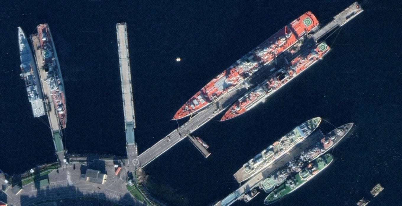
Google Maps made Russia’s strategic facilities visible to users Monday, revealing the details of the country’s military infrastructure.
Searches on Google Maps showed newly accessible images of military bases, intercontinental ballistic missiles launch pads, naval facilities and key command posts all across Russia.
“Now everyone can see [Russian military infrastructure] with a resolution of about 0.5 meters per pixel,” tweeted the Ukrainian armed forces.
Some of the newly-available images include the Admiral Kuznetsov aircraft carrier, a nuclear weapons store near Murmansk, submarines in the Far East peninsula of Kamchatka, and a military airbase in the Western city of Kursk, just 150 kilometers from the Russian-Ukrainian border.
The move comes amid strained relations between Russia and U.S. tech giant Google.
Google banned advertisements for Russian users following the Kremlin’s invasion of Ukraine, and Russian officials have accused Google-owned YouTube of stirring an “information war” after the video-hosting platform blocked Russian state media.
Satellite images of military facilities are traditionally blurred, or displayed in lower quality, by Google Maps to protect their classified status.
knollm12 on April 18th, 2022 at 18:28 UTC »
Next: Russia warns Google against NATO membership
TheBoatyMcBoatFace on April 18th, 2022 at 18:14 UTC »
Two Typhoon Class submarines here
64°34'30"N 39°46'16"E · -0.15 ft
Reselects420 on April 18th, 2022 at 15:36 UTC »
But when were they last updated?