Before explaining what is coming for the Polar Vortex and our Winter weather, we will quickly learn what exactly is the Polar Vortex.
In essence, the polar vortex is like a large cyclone, that forms when the stratosphere over the North Pole starts to cool down.
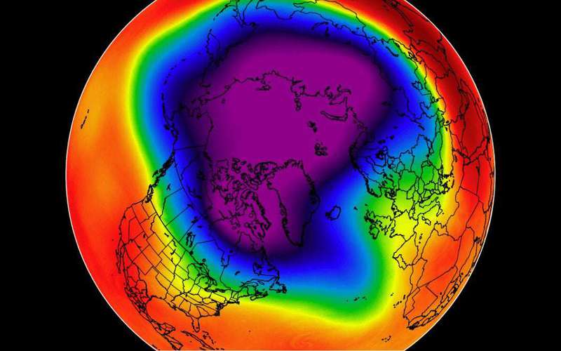
The image below shows a typical example of the Polar Vortex at around 46km altitude (1mb level) near the top of the stratosphere.
You can see that the polar vortex really is like a very large cyclone, covering the whole north pole down to the mid-latitudes.
You can see on the image above what the true extent of the polar vortex looks like at lower altitudes in Winter.
This is the heart of the Polar Vortex, as the colder it gets, the stronger the polar vortex can become.
This is why the state of the stratospheric polar vortex is important, as well as the phase of the QBO. »