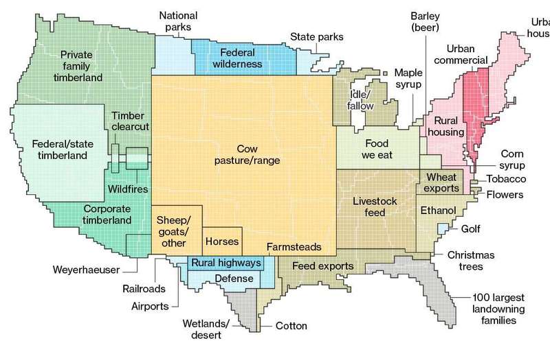
The data can’t be pinpointed to a city block—each square on the map represents 250,000 acres of land.
But piecing the data together state-by-state can give a general sense of how U.S. land is used.
More than one-third of U.S. land is used for pasture—by far the largest land-use type in the contiguous 48 states.
And nearly 25 percent of that land is administered by the federal government, with most occurring in the West.
Between pastures and cropland used to produce feed, 41 percent of U.S. land in the contiguous states revolves around livestock.
Putting all those pieces together, this map gives you a rough sense of all the ways U.S. land is used.
Much of U.S. land serves specific purposes, such as the 2 million acres devoted to golf courses or the 3 million acres for airports. »


![image for Little River in Maine [oc][6000x4000]](65a7bbff-d537-5d5a-a573-7288665b3b32_thumb.jpg)


![image for Bed bath and beyond | Kiev, Ukraine [1582 x 995]](7a073aca-de34-53c9-aa30-de960bb619c7_thumb.jpg)