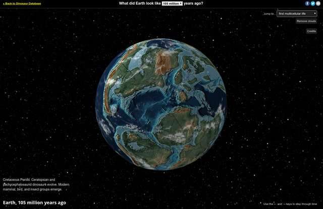
This visualization is created and maintained by Ian Webster. See more of my work at ianww.com or email me at [email protected].
Plate tectonic and paleogeographic maps by C.R. Scotese, PALEOMAP Project. For more information visit: https://www.earthbyte.org/paleomap-paleoatlas-for-gplates & www.globalgeology.com.
LocationIQ has kindly provided the address search tool.
Some elements of this visualization are not adjusted for time (eg. cloud and star positions). The coloring of the Earth is approximate and so are reconstructed locations.
SergePower on June 26th, 2018 at 10:56 UTC »
90M years ago, there was a giant river/sea cutting right through north america. Neat.
LookAtMyKeyboard on June 26th, 2018 at 10:11 UTC »
How unfair, this doesn't work for Iceland. Then I remembered why.
guutala on June 26th, 2018 at 08:31 UTC »
This is fun. tracking Burgess Shale, and tracking Indian subcontinent, tracking Japanese archipelago. Thanks for this post.